This article is the second part of our trip to
Eastern Anatolia. To read the first part, please click here: First stop: Van.
After visiting our last stop, Van Cat House, we
headed to the Ağrı’s famous town
Doğubeyazıt. During the trip we took two breaks. One was in Şeytan
Köprüsü (Devil’s Bridge), the other one was in Muradiye Şelalesi
(Muradiye Waterfall). Both were
in Muradiye village of Van, close to the Ağrı’s border.
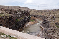
Şeytan Köprüsü (39°01'21.4"N 43°44'50.3"E) is a little bridge on a narrow valley
with beautiful flowers. This 19th century’s bridge is just 15 meters
long and 18 meters high from the valley. Because of its narrowest wideness
(only 3 meters) it can be dangerous for people. According to a legend, after a
wedding regiment fall off during their passage across the bridge, the people of
the region started to call the bridge devil’s bridge.
After the bridge, we passed to the waterfall.
It took 15 minutes by car.
Muradiye Şelalesi (39°03'24.4"N 43°45'25.5"E) is not so
high (around 20 meters) but it offers a nice view. To clearly see the fall, you
have to pass a drawbridge.
We ate our lunch here, it was good but there
was no so many choice so you may prefer to eat before living Van or when
arriving to Doğubeyazıt (Restaurants and supermarkets options are very limited
during the trip between these two cities).
After the waterfall, when you drive about 30
minutes, you will reach the volcanic
zone of Mount Tendürek which is a shield volcano. The mountain reaches 3533 meters and dates 700,000–500,000 years BP
to 13,000 BP. It is mostly constructed from basaltic lavas. The last known
activity had been a gas and ash eruption in 1855 and the hot vapor activities
still continue.
The ashes at the feet of the mountain were
really stunning.
 |
| When approaching to Dogubeyazit, you will see the Mount Ararat |
 |
| Entrance of the city |
After this landscape we arrived to our hotel.
There is not too much choice for hotels in Doğubeyazıt, we stayed at Boutique Ertur Hotel. It was clean, the
staff was kind and the breakfast was good.
When we arrived the town, it was a little bit
late and the weather was foggy. So we did not manage to see the Mount Ararat (Turkish: Ağrı Dağı).
Doğubeyazıt
is easternmost district of Turkey on the Iranian border and 1625 meters above
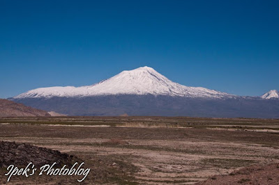
sea level. Mount Ararat is 5137 meters. Snow-capped Ararat Mountain is
the highest mountain in Turkey and it is also the highest in Europe (if we
did not count the Russian and Georgian mountains). Doğubeyazıt is the best
place in Turkey to see Mount Ararat. Just beside the Ararat there is also a
Little Ararat, but it is not so little actually, it is 3896 meters.
 |
| Mount Ararat |
Mount Ararat and Little Ararat in two different angles:
Iranian Border, Gürbulak:
Doğubeyazıt is well known also with a stone
formation believed to be Noah's ark.
We did not go there but it is possible to visit.
We stayed only one night in Doğubeyazıt. During
the night it had snowed. In the
morning we found that snow made a fairylike scenery. Thanks to snow, the weather got clear and we saw
Mount Ararat too.
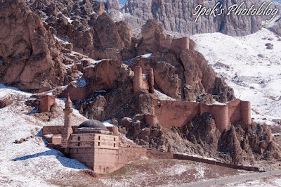
After the breakfast we went directly to Ishak Pasha Palace (Turkish: İshak
Paşa Sarayı). It is a semi-ruined palace complex near the center of
town. The full construction of the
palace takes 100 years (between the years 1685 - 1784).
Below, the left picture shows bath and the right picture shows the kitchen area:
There is a mosque inside the place:
There was also a castle in front of the palace:
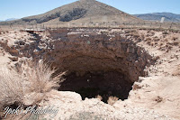
After the palace we went to the meteor
crater close to the Iranian border. Actually this is not a meteor
crater but a pit cave, but when we visited
we didn’t know this information. Visiting the pitch is free of charge but it is
in a military zone in the border, so you have to pass an identity control and
sometimes, because of military duties, the passage is close.
Mount Ararat from the pit:
Then we headed to Erzurum. During the trip we
took a lunch break in Ağrı. We ate
in a home cooking style restaurant. It was really delicious but unfortunately I
do not recall the name, it was a new opened restaurant. We parked our car
(parking: 39°43'14.3"N 43°03'03.6"E) and then found this place by
chance on Bülbül Caddesi, number 57.
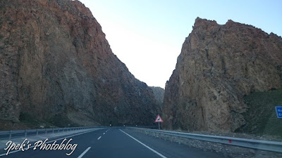
Heading to Erzurum:
 |
| One last picture of Mount Ararat :D |
 |
| Çobandede Bridge |
After lunch, we continued to Erzurum. From
Doğubeyazıt to Erzurum our trip took 3h30minutes (from Ağrı it takes 2h15min.).
For reading my Erzurum notes, pleasevisit the article about the third and last part of our journey.












0 yorum:
Yorum Gönder